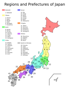
Okinawa Prefecture
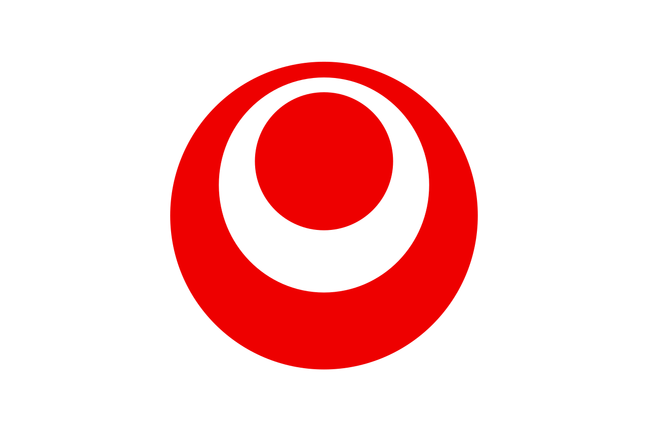
Prefecture with a flag adopted October 13, 1972, featuring a red, white, and red emblem.

Wikipedia / Wikimedia Commons
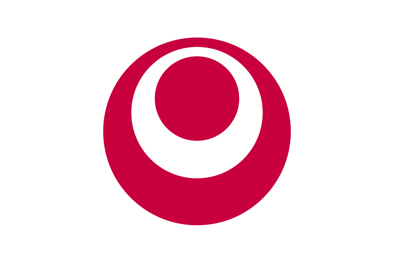
Okinawa Prefecture is the southernmost and westernmost prefecture of Japan. Its flag is a white field charged in the center with the prefectural emblem, which consists of three circles stacked on top of each other. The two inner circles are positioned upwards; the outermost and innermost circles are red and the middle circle is white. The emblem was adopted on May 15, 1972, when the United States ended its administration of the Ryukyu Islands and returned Okinawa Prefecture to Japan. The flag was adopted shortly afterward on October 13, 1972.
- capital
- Naha
Verified Timeline
Lore & Background
The Empire of Japan transformed its vassal, the Ryukyu Kingdom, into the Ryukyu Domain in 1872 and annexed it outright in 1879, establishing Okinawa Prefecture. Historian Daisaku Kina states that the de jure independent kingdom most likely did not have a national flag as it did not have the Western notion of needing one. The U.S. militarily occupied the Ryukyu Islands after defeating Japan in the Pacific War of World War II. While the Amami Islands of Kagoshima Prefecture were returned to Japan in 1953, Okinawa Prefecture remained under U.S. administration until 1972. During the period of U.S. rule, the U.S. flag was the only national flag permitted to fly in Okinawa Prefecture. The Okinawa Civil Government introduced in January 1950 a Ryukyuan flag designed by the Okinawa Artists' Association. It was a horizontal tricolor of blue, white, and red charged with a white star in the upper hoist-side corner. The flag received little attention from the Okinawan public and its planned adoption was scrapped. To counter growing calls for Okinawa Prefecture's return to Japan, the U.S. administration created its own Ryukyuan flag in 1954, based on the family crest of the second Shō dynasty. The U.S. administration flew the flag at Ryukyu-American Friendship Centers but soon grew disappointed with the Okinawans' apathy toward the former royal family's symbol. Realizing that few Okinawans identified with the flag, the U.S. administration discontinued its Ryukyuan flag scheme. During the period of U.S. rule, merchant ships from Okinawa Prefecture could not fly the U.S. flag nor the Japanese flag as their civil ensign. The U.S. administration attempted to remedy this by proclaiming on February 27, 1952, the adoption of a 'Ryukyuan ship flag' – a signal flag letter D (Delta) with a triangle at the fly cut off. This caused routine confusion among other ships, culminating in the Kyuyo Maru incident of 1962, in which an Okinawan fishing boat that had entered Indonesian territorial waters was shot at by an Indonesian naval aircraft that could not deduce the boat's nationality. One Okinawan fisherman was killed while four were wounded, resulting in an uproar on the islands and demands for the Japanese flag to be adopted as the Okinawan civil ensign. The issue ultimately made it to the Japan–U.S. Consultative Committee of 1967, in which the two countries agreed that Ryukyuan ships would henceforth fly the Japanese flag alongside a triangular flag with the name 'Ryukyus' written in Japanese kanji (琉球) and all caps in English (RYUKYUS).
Reader's Guide
After diplomatic meetings in 1969, the U.S. agreed to return Okinawa Prefecture to Japan within three years. Following the signing of the 1971 Okinawa Reversion Agreement, the Japanese government held a public, nationwide competition to design an emblem for the prefecture. A total of 186 designs were submitted. On April 24, 1972, the Prefectural Emblem Selection Committee chose a design submitted by a man from Kyoto Prefecture and decided that the color scheme would be blue, white, and red from the outermost to innermost circle. However, the committee soon discovered that the chosen design and colors resembled the mark of the All Japan Kendo Federation, and so the innermost circle was changed from red to blue on May 9. The emblem became official six days later on May 15, when the Ryukyu Islands were returned to Japan. On October 13, the prefectural government announced the adoption of the prefectural flag and the changing of the prefectural emblem's blue circles to red. The flag is a white field charged in the center with the emblem of Okinawa Prefecture. The emblem consists of three circles stacked on top of each other, alternating between red and white. The inner two circles are positioned upwards. The outermost circle is red and represents the Pacific Ocean, which surrounds Okinawa Prefecture. The middle circle is white and represents the letter O in the rōmaji spelling of 'Okinawa'. It is also meant to symbolize a circle of people united together. The innermost circle is red and represents the prefecture's potential for development. Accordingly, the Okinawa Prefectural Government describes the emblem itself as 'a symbol of the ocean, peace, and development.' According to the prefectural notice that introduced the flag, the emblem's shade of red is Munsell value 3.5R 4/16, or hexadecimal code #C5003B. However, the flag on the prefectural government's official website uses a different shade of red, hexadecimal code #DC000C.
The emblem is a symbol of the Okinawa Prefectural Government and its use is restricted to official government activities and operations. Examples include its display on prefectural appointment letters, awards, publications, and government vehicles, as well as at prefectural housing and prefectural government–sponsored events. The prefectural government noted a number of misuses of the emblem by private enterprises in the 2010s, including direct misuses and the use of similar, adapted designs on products. In response, the prefectural government published an explanation on its website about the history and usage of the emblem.
Did You Know?
- The flag was adopted on October 13, 1972, just months after the prefecture's return to Japan on May 15, 1972.
- The emblem's design was chosen from 186 submissions in a nationwide competition, but the original color scheme (blue, white, red) was changed because it resembled the mark of the All Japan Kendo Federation.
- During U.S. administration, the only national flag permitted to fly in Okinawa Prefecture was the U.S. flag.
- The Kyuyo Maru incident of 1962, in which an Okinawan fishing boat was shot at by an Indonesian aircraft, led to demands for the Japanese flag to be used as the Okinawan civil ensign.
- The prefectural government noted misuses of the emblem by private enterprises in the 2010s and published an online explanation about its history and proper usage.
A Prefecture Set Apart
Okinawa Prefecture occupies a distinctive place within Japan's administrative landscape. While the nation's 47 prefectures form the first tier of local jurisdiction beneath the national government, Okinawa's legal journey diverged from the standard path for a considerable period. Under the local government legislation enacted between 1888 and 1890, the typical prefectures—then numbered three fu and forty-two ken—were organized into cities, districts, towns, and villages. Okinawa-ken, however, was excluded from this framework and remained subject to separate legal provisions until the twentieth century. This meant that for decades, the mechanisms of local governance that shaped the rest of the country did not apply in the same way to Okinawa. The turning point came with the Local Autonomy Law of 1947, which extended greater political authority to prefectures across the country, including the installation of directly elected governors and representative assemblies. For Okinawa, this legislation marked the full integration of its governance into the modern prefectural system that had been consolidating since the Meiji era.
Governance and Identity
As a ken-type prefecture, Okinawa operates under the same structural template as the other forty-three prefectures proper. At the helm sits a directly elected governor, known in Japanese as chiji, who serves as the chief executive of the prefecture. Legislative and budgetary authority rests with a unicameral assembly, or gikai, whose members are chosen by voters for four-year terms. Together, the governor and assembly enact ordinances and manage the prefectural budget. Like every other prefecture, Okinawa also bears its own mon, a heraldic emblem that functions as the local equivalent of a Western coat of arms and serves as a visual identifier for the region. The term "prefecture" itself carries an interesting etymological legacy: it traces back to sixteenth-century Portuguese traders who used the word prefeitura to describe the fiefdoms they encountered in Japan. Though the original Portuguese sense leaned closer to "municipality," the rough translation endured, and today the Japanese word ken is even used to label Portuguese districts in Brazil, where Prefeitura refers to a city hall.
Powers Within a Unitary State
Japan's unitary structure means that Okinawa Prefecture, like all others, exercises its authority within a framework ultimately controlled by the central government. The national government delegates numerous functions to prefectures and municipalities, including the organization of the prefectural police force, the supervision and maintenance of schools—primarily high schools—prefectural hospitals, road networks, waterway management, and regional urban planning. Local government expenditure accounts for roughly seventy percent of total government spending, yet the central government retains control over local budgets, tax rates, and borrowing. In practice, prefectures and municipalities often enjoy less autonomy than the formal provisions of the Local Autonomy Law suggest. Many municipalities depend heavily on central government funding, a dependency that has been further strained in recent decades by declining populations that hit rural areas harder and earlier than urban centers. In most policy areas, the basic framework is set tightly by national legislation, and prefectures operate autonomously only within that prescribed boundary.
From 300 to 47: The Shaping of Modern Boundaries
The prefecture system that Okinawa now belongs to was forged through a dramatic reshaping of Japan's administrative map. In 1868, the Meiji-era Fuhanken sanchisei administration established the first prefectures, replacing the old urban and rural administrators in regions that had been under direct shogunate control. The following year, the abolition of the feudal han system transformed all remaining domains into prefectures, briefly producing more than three hundred of them. A series of consolidation waves reduced this number to seventy-two by late 1871 and to the current forty-seven by 1888, with many of today's boundaries aligning with the ancient ritsuryō provinces. The system has not been immune to further reform proposals. In 2003, Prime Minister Junichiro Koizumi put forward a plan to merge the existing prefectures into roughly ten regional states, or dōshūsei, granting them greater autonomy and reducing administrative costs. The government also explored creating between nine and thirteen subnational states with expanded local powers. This ambitious restructuring was ultimately abandoned in 2012, leaving the prefecture system intact.
Gallery


Frequently Asked Questions
What is Okinawa Prefecture?
Okinawa is Japan's southernmost and westernmost prefecture, a subtropical archipelago whose capital is Naha. It stretches across three island groups and covers roughly 2,281 square kilometres of land.
How many islands make up Okinawa Prefecture?
The prefecture contains 160 islands in total, though only 49 are actually inhabited. They fall into three main groups: the Okinawa Islands, the Sakishima Islands, and the Daitō Islands.
What was Okinawa before it became part of Japan?
Prior to 1879 the region was the heart of the Ryukyu Kingdom, a maritime trading power that maintained tributary ties with the Ming and Qing dynasties. Japan formally absorbed the kingdom through the Ryukyu Disposition that same year.
What is the capital of Okinawa Prefecture?
Naha serves as the prefectural capital, sitting on the main island and acting as the administrative and commercial anchor of the entire archipelago.
Why is Okinawa Prefecture important?
Okinawa carries a distinct historical identity as the former seat of the Ryukyu Kingdom and a crossroads of East Asian sea trade. Its postwar period under U.S. administration until the 1972 reversion, combined with its continued hosting of a large share of American military facilities, keeps it at the centre of both cultural and geopolitical conversation.
More in Prefectures Of Japan 25-39
Related in Prefectures Of Japan
Links follow this subject's own source article.
Elsewhere in the Prefectures Of Japan universe
Spotted an error? Know more?
This is a living reference — every entry is fact-audited, and reader corrections feed straight into our audit queue. Suggest an edit · See this site's audit record