Okayama Prefecture
Prefecture in Japan's Chūgoku region, home to Momotarō legend.

Wikipedia / Wikimedia Commons
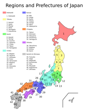
Okayama Prefecture (岡山県, Okayama-ken) is a prefecture of Japan located in the Chūgoku region of Honshu. It has a population of 1,815,165 (as of 1 October 2025) and a geographic area of 7,114 km². The capital and largest city is Okayama, with other major cities including Kurashiki, Tsuyama, and Sōja. The prefecture is bordered by Tottori Prefecture to the north, Hyōgo Prefecture to the east, and Hiroshima Prefecture to the west, and faces Kagawa Prefecture across the Seto Inland Sea, connected by the Great Seto Bridge. The south is located on the Seto Inland Sea coast, while the north is characterized by the Chūgoku Mountains.
- capital
- Okayama
- population
- 1,815,165 (1 October 2025)
- area
- 7,114 km² (2,746 sq mi)
- region
- Chūgoku region, Honshu
- formed
- 1871 (borders set in 1876)
- major_cities
- Okayama, Kurashiki, Tsuyama, Sōja
Verified Timeline
Lore & Background
Prior to the Meiji Restoration of 1868, the area of present-day Okayama Prefecture was divided between Bitchū, Bizen and Mimasaka Provinces. The prefecture was formed and named in 1871 as part of the large-scale administrative reforms of the early Meiji period (1868–1912), and its borders were set in 1876. The prefecture's south lies on the Seto Inland Sea coast across from Kagawa Prefecture on the island of Shikoku, which are connected by the Great Seto Bridge, while the north is characterized by the Chūgoku Mountains. Okayama Prefecture includes 90 islands in the Seto Inland Sea.
Reader's Guide
Okayama Prefecture is closely associated with the folklore hero Momotarō. This tale is said to have roots in the legendary story of Kibitsuhiko-no-mikoto and Ura, which explains that Prince Ura of Kudara used to live in Kinojo (castle of the devil) and was a cause of trouble for the people. The emperor's government sent Kibitsuhiko-no-mikoto (Momotarō) to defeat Ura. The city of Okayama holds an annual Momotarō-matsuri, or Momotarō Festival. The prefecture is home to the historic town of Kurashiki. Most of the population is concentrated around Kurashiki and Okayama. The small villages in the northern mountain region are aging and declining in population — more than half of the prefecture's municipalities are officially designated as depopulated. As of 1 April 2014, 11% of the total land area of the prefecture was designated as Natural Parks, namely the Daisen-Oki and Setonaikai National Parks; the Hyōnosen-Ushiroyama-Nagisan Quasi-National Park; and seven Prefectural Natural Parks. Per Japanese census data, Okayama prefecture has had continual negative population growth since 2005. Notable cultural elements include Bizen-yaki (Bizen pottery) and Bizen Osafune/Bitchu Aoe swords. Tourist attractions include Koraku-en Japanese garden in Okayama, Okayama Castle, Bitchu Matsuyama Castle in Takahashi, the Ohara Museum of Art in Kurashiki, and the Bikan Historical Area in Kurashiki.
Did You Know?
- Okayama Prefecture includes 90 islands in the Seto Inland Sea.
- More than half of the prefecture's municipalities are officially designated as depopulated.
- As of 1 April 2014, 11% of the total land area was designated as Natural Parks.
- The Momotarō legend is said to have roots in the story of Kibitsuhiko-no-mikoto defeating Prince Ura of Kudara at Kinojo.
- The prefecture has had continual negative population growth since 2005.
Geography & Natural Landscape
Okayama Prefecture occupies a distinctive stretch of Honshu's Chūgoku region, stretching from the Seto Inland Sea in the south to the rugged Chūgoku Mountains in the north. Its 7,114 square kilometers of territory border Tottori Prefecture to the north, Hyōgo to the east, and Hiroshima to the west, while the southern coastline faces Kagawa Prefecture on the island of Shikoku across the sea. The Great Seto Bridge links the two shores, and the prefecture claims 90 islands scattered throughout the Inland Sea. This geographic duality—coastal openness on one side and a mountainous interior on the other—shapes much of the region's character and daily life. As of April 2014, eleven percent of the total land area was formally designated as protected natural space, encompassing the Daisen-Oki and Setonaikai National Parks, the Hyōnosen-Ushiroyama-Nagisan Quasi-National Park, and seven additional Prefectural Natural Parks. The contrast between the bustling coastal cities and the quiet, forested highlands remains the defining physical feature of the prefecture.
Historical Formation & Administrative Identity
Before the sweeping administrative reorganization that followed the Meiji Restoration of 1868, the territory now known as Okayama Prefecture was split among three separate provinces: Bitchū, Bizen, and Mimasaka. The modern prefecture was formally created and given its name in 1871, a direct product of the large-scale governmental reforms enacted during the early Meiji period spanning 1868 to 1912. The precise borders that define Okayama today were finalized in 1876, after a period of adjustment. This consolidation of three historically distinct provinces into a single administrative unit gave the region a unified political identity for the first time in centuries. The prefecture's capital and largest city, Okayama, anchors the administrative center, while Kurashiki, Tsuyama, and Sōja serve as other major urban nodes. The legacy of those three provincial identities—Bitchū, Bizen, and Mimasaka—still echoes in local place names, cultural traditions, and the distinct character of different sub-regions within the prefecture.
Cultural Heritage & Folklore
Okayama Prefecture carries a rich cultural heritage that spans centuries of craftsmanship and storytelling. Bizen-yaki, the region's traditional pottery, and the famed Bizen Osafune and Bitchu Aoe swords represent enduring artisanal traditions rooted in the old Bizen and Bitchū provinces. Perhaps the most widely recognized cultural association is the legend of Momotarō, the folklore hero whose tale is said to trace back to the ancient story of Kibitsuhiko-no-mikoto and Ura. In that narrative, the Prince Ura of Kudara dwelt in Kinojo, a castle of the devil, troubling the villagers until the emperor's government dispatched Kibitsuhiko-no-mikoto to defeat him. The city of Okayama honors this legend each year with the Momotarō-matsuri festival. Beyond folklore, the prefecture hosts numerous cultural institutions, including the Hayashibara Museum of Art, the Ohara Museum of Art in Kurashiki, the Yumeji Art Museum, the Okayama Prefectural Museum of Art, and the Okayama Symphony Hall, reflecting a deep commitment to the visual and performing arts.
Demographic Challenges & Urban Concentration
Okayama Prefecture, home to approximately 1,815,165 residents as of October 2025, faces a persistent demographic challenge. Japanese census data confirm that the prefecture has experienced continual negative population growth since 2005, a trend that shows no sign of reversal. The population is heavily concentrated in and around the cities of Okayama and Kurashiki, which together anchor the region's economic and social life. In stark contrast, the small villages scattered across the northern mountainous interior are aging rapidly and losing residents. The situation has reached a critical point: more than half of the prefecture's municipalities are officially designated as depopulated areas. This urban-rural divide creates significant pressure on local services, infrastructure maintenance, and community vitality in the highland regions. The prefecture's 15 cities, along with its towns and villages, must navigate this imbalance as the gap between the thriving coastal urban centers and the quiet, shrinking mountain communities continues to widen.
Gallery

Frequently Asked Questions
Who is Okayama Prefecture?
Okayama is a Chūgoku-region prefecture on the western stretch of Honshu, with its administrative seat in the city of Okayama itself. As of October 2025 it shelters roughly 1.8 million residents spread across about 7,114 square kilometres of land.
What are Okayama Prefecture's powers/role?
It acts as the Chūgoku region's principal gateway to Shikoku, tied to Kagawa Prefecture by the Great Seto Bridge spanning the Seto Inland Sea. It is also the cultural home of the beloved Momotarō folk tale, a fact fans cite whenever the prefecture's identity comes up.
How does Okayama Prefecture's story end?
There is no fixed ending — it continues as a living region whose modern borders were locked in during the 1876 Meiji reorganization. Its ongoing narrative is one of linking inland Chūgoku communities to the sea-facing world beyond the Seto Inland Sea.
Why is Okayama Prefecture important?
It occupies a crossroads position, touching Tottori to the north, Hyōgo to the east, and Hiroshima to the west, which makes it a natural hub along the western Honshu corridor. Its cluster of major urban centres — Okayama, Kurashiki, Tsuyama, and Sōja — anchors the region's economy and cultural life.
What are Okayama Prefecture's major cities?
Beyond the capital city of Okayama, fans most often point to Kurashiki (well known for its historic port district), Tsuyama, and Sōja as the prefecture's other key urban centres. Together they give the prefecture a diverse identity stretching from coastal to mountainous terrain.
More in Prefectures Of Japan 25-39
Related in Prefectures Of Japan
Links follow this subject's own source article.
Elsewhere in the Prefectures Of Japan universe
Spotted an error? Know more?
This is a living reference — every entry is fact-audited, and reader corrections feed straight into our audit queue. Suggest an edit · See this site's audit record